

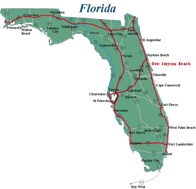
Map of Florida
Florida Map
Orlando International Airport is located 9 miles southeast of downtown
Orlando, at the junction of State Road 436 (SR 436 - Semoran Boulevard)
and State Road 528
Directions to the Orlando International Airport
Directions to the Orlando International Airport From the North
(Altamonte Springs, Sanford, etc.)
Take Interstate 4 to SR 417 (Greeneway) near Sanford
Take SR 417 (Greeneway) south to Orlando International Airport
Or,
Take Interstate 4 west to SR 408 (East-West Expressway) in downtown Orlando
Take SR 408 (East-West Expressway) east to SR 436 (Semoran Boulevard)
Take SR 436 (Semoran Boulevard) south to Orlando International Airport
Or,
Take Interstate 4 west to SR 528 (Beeline Expressway) near International
Drive/SeaWorld
Take SR 528 (Beeline Expressway) east to Orlando International Airport
(Exit 11B)
Directions to the Orlando International Airport From the South/West
(Tampa, Walt Disney World, Lake Buena Vista, etc.)
Take Interstate 4 east to SR 528 (Beeline Expressway) near International
Drive/SeaWorld
Take SR 528 (Beeline Expressway) east to Orlando International Airport
(Exit 11B)
Or,
Take Interstate 4 east to Exit 24E onto SR 417 (Greeneway) near Lake Buena
Vista
Take SR 417 (Greeneway) north to Boggy Creek Road
Take Boggy Creek Road north to the South Entrance Road
Take the South Entrance Road north to Orlando International Airport
Directions to the Orlando International Airport From the East (Port
Canaveral, Cocoa Beach, Titusville, etc.)
Take Interstate 95 to SR 528 (Beeline Expressway) near Cape Canaveral
Take SR 528 (Beeline Expressway) west to Orlando International Airport
(Exit 11B)
Directions to the Orlando International Airport From the Florida Turnpike
Take the SR 528 (Beeline Expressway) exit from the Turnpike
Take SR 528 (Beeline Expressway) east to Orlando International Airport
(Exit 11B)
Terminal
Map of Orlando International Airport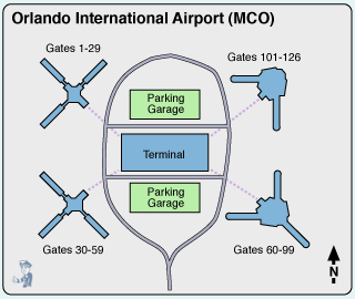
Directions
From the Orlando International Airport to locations near Orlando:
Directions
To the Orlando Convention Center (approximately 15 miles)
Take the North
Exit Road from Orlando International Airport to SR 528 (Beeline Expressway)
Take
SR 528 (Beeline Expressway) west to Exit 1 and follow signs to the Convention
Center
Directions To the Florida Turnpike
Take the North Exit
Road from Orlando International Airport to SR 528 (Beeline Expressway)
Take
SR 528 (Beeline Expressway) west to the Florida Turnpike exit
Directions
To International Drive (approximately 15 miles)
Take the North Exit Road
from Orlando International Airport to SR 528 (Beeline Expressway)
Take SR 528
(Beeline Expressway) west to Exit 1 and follow signs to International Drive/Convention
Center
Directions To Lake Buena Vista (approximately 20 miles)
Take the North Exit Road from Orlando International Airport to SR 528 (Beeline
Expressway)
Take SR 528 (Beeline Expressway) west to Interstate 4
Take Interstate
4 west to Lake Buena Vista
Directions To Sea World (approximately
18 miles)
Take the North Exit Road from Orlando International Airport to SR
528 (Beeline Expressway)
Take SR 528 (Beeline Expressway) west to Exit 1 and
follow signs to Sea World
Directions To Universal Orlando (approximately
18 miles)
Take the North Exit Road from Orlando International Airport to SR
528 (Beeline Expressway)
Take SR 528 (Beeline Expressway) west to Interstate
4
Take Interstate 4 east and follow signs to Universal Orlando
Directions
To Walt Disney World (approximately 22 miles)
Take the South Exit Road
from Orlando International Airport to SR 417 (Greeneway)
Take SR 417 (Greeneway)
west and follow signs to Walt Disney World
Map
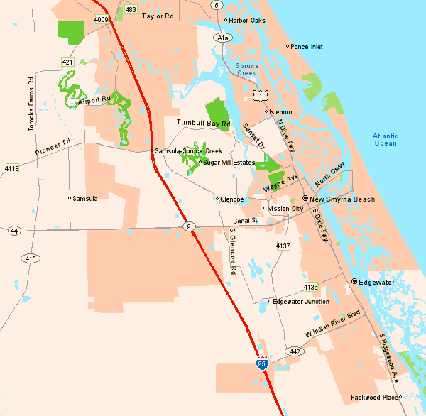
of New Smyrna Area
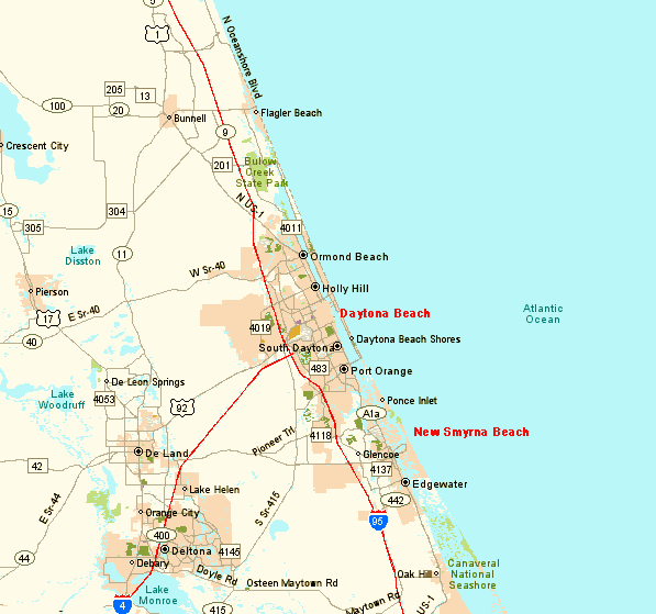
Map
of Daytona Beach Area